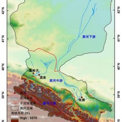
Heihe River Basin
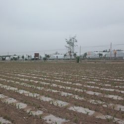
The Heihe River basin (China) is in the arid region of northwest China, it is the second largest inland river basin in China, characterized by cold and arid landscapes. Water conflict between ecosystem’s demand and agriculture is severe. The middle stream area is characterized by typical irrigated artificial oasis and desert.
Website
Irrigation type
Irrigation water used comes mainly from the Heihe River through irrigation canals. Groundwater depletion is increasing year by year due to insufficient water table recharge. Intensive use of water for crop irrigation in growing season results in less or even cut-off of river water flow to the lower reaches every year.
Crop types
The primary crops are maize, spring wheat, vegetables and small fraction of orchards.
Data availability
Meteorological data from the regional network, hydrological stations, several eddy covariance stations (soil moisture, evapotranspiration), satellite data in the visible and thermal infrared, soil type, land use.


